It’s cold, snowing, and the wind attempted to knock us off our feet most of the day. Fortunately on this bike trail we were a bit protected from the wind because the reality of how windy it actually was illustrated at every street crossing. 😩
Have I set the scene? We’re ridiculous, but we’re even more ridiculously motivated to get a week of backpacking under our belt. We haven’t been on a long backpacking trip since the summer of 2019 because of my necessary foot surgeries and then, well everyone knows what happened in March 2020.
The goal: To walk from Springfield, OH (north of Dayton) to Covington, KY on the Little Miami River Trail. Throughout the week, we are staying with fellow hikers, friends, an albergue-style home, and two hotels (because a good Camino always needs a splurge). It will be 90 miles over 7 days of walking, averaging just under 13 miles a day.
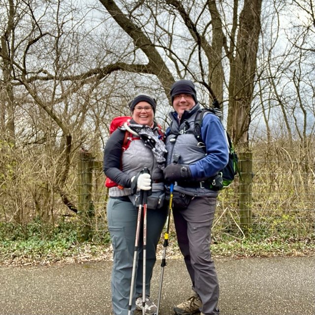
Today was supposed to be an easy 8.5 mile flat trail walk and Mother Nature tried to challenge us but alas we pressed on. Tonight we’re staying in an Air B&B in Yellow Springs at the Corry Street Retreat. It’s adorable and definitely feels like a Camino accommodation with 3 rooms, 3 detached bathrooms, and a common area with a full kitchen.
Corry Street Retreat from Air B&B in Yellow Springs, Ohio
It’s going to be a great week. We’ll have more cold, another dash of wind, sunshine, and even a 74 degree day. But we’re together and our only goals are walking, washing our clothes, and eating. If you want more, here’s a video from day 1 and day 2 on the trail: click here.
Total for today: 8.5 miles; $213 with $137 for food and $76 for our accommodations.
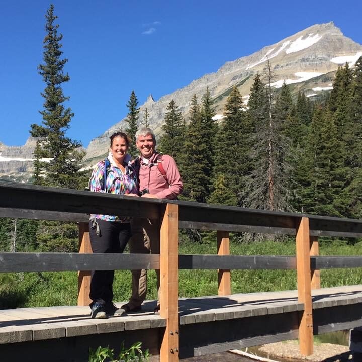
In 2016, we hiked and camped at Glacier National Park. This was a part of our two month trip out west, we affectionally called it the #GoWestColemans trip. 2016 was the year hashtags became trendy and since we name every trip, it was a great way to embrace the trend, haha. You can see the complete trip map, by clicking here.
We were apprehensive about camping and hiking Glacier National Park; the park is home to majestic wildlife and we had a lot to learn how about to share space with the animals. With a bit of research, asking questions of those who have gone before us, and a lot of preparation, we were ready. In this blog, I am going to share what we saw, how we prepared, our favorite hikes, and where we camped.
Below are photos of the wildlife we witnessed at Glacier National Park. We were lucky enough to hear about a family of moose eating in a lake very close to the Many Glacier Campground Store so we wandered off to see them. I had about 50+ photos on my phone similar to what you see below. We watched the moose graze in the lake for hours and it was the most fascinating scene we have ever witnessed.
The many animals we witnessed at Glacier National Park
We spent a day hiking the Highline Trail and we heard that if you don’t see wildlife, you are doing something wrong. We saw the mountain goat in the lower-left photo within the first 5 minutes and the only other animal we saw the entire day was the marmot in the lower right photo. The bighorn sheep (top right) posed for their photo-op in the parking lot at the end of our day. I am sure a lot of animals had human sightings but they really are not interested in being noticed.
The only time we saw a grizzly bear was when we were driving, the photo in the lower middle. We were prepared with our bear bells and bear spray…most of the time. You should have a bear bell and spray on you at all times when you are in Glacier National Park because you never want to surprise a grizzly bear. We made a mistake. We walked from the campground to the hotel for an afternoon break. This is a 1/2 mile walk and honestly, we weren’t hiking so we didn’t think about our bear bells or spray. Once we arrived at the hotel we saw several park police where we had just walked. A grizzly bear was sighted on our trail. We were lucky he wasn’t interested in us and we didn’t startle him, we didn’t even see him. However, I sang loudly to Brian the entire walk back. My rendition of 99 Bottles of Beer on the Wall had me laughing, but Brian may have been just shaking his head at me. The moral to the story: always carry a bear bell and spray in Glacier National Park.
Can you see my motion sickness patch? Going To The Sun Road was rough!
There is something majestic and romantic at Glacier National Park. You are surrounded by mountains, glaciers, lakes, and waterfalls. Everything around you feels massive and perfect. We were certainly caught in the magic of the park. I wish we would have allowed more time here. The park is enormous and you need to spend time on one side of the park and then move to the other side. We camped at Many Glacier Campground but I wish we would have also camped at Fish Creek Campground so we could have spent time on that end of the park. We came into the park from the south so we were able to drive much of it and visit the Apgar Visitor Center; however, we spent most of our time in the Logan Pass Visitor Center and Many Glacier Hotel/Campground area. Just to give you an idea of how large the park is, it took us about 75 minutes to drive from our campground to the Logan Pass Visitor Center.
Brian mourning the decline of the glaciers
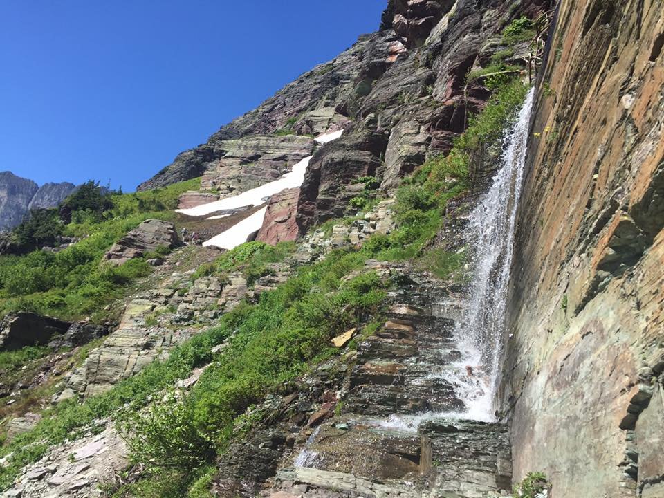
I would be remiss if I didn’t talk about the ever-changing glaciers. There was an exhibition at Many Glacier Hotel where they showed photos of what the glaciers looked like and recreated the same photos with how the glaciers look now. You can read about the Repeat Photography Project by clicking here. Climate change becomes extremely real when you see the glaciers in person. Fortunately, there is a lot we can do if we are willing to be a part of the change. You can read about how the glaciers are changing by clicking here.
Our two favorite hikes were the Grinnell Glacier hike and the Highline Trail hike. The photos above are from both hikes. You can only access Grinnell Glacier by boat out of the Many Glacier Hotel, pictured below. The Grinnell Glacier hike includes a lake, waterfalls on your trail, mountains all around you, and glaciers that you can walk on (in 2016). We saw bighorn sheep on the trail, one even led the hike for a bit (with a good distance between us).
The Highline Trail is fantastic because you are high above the Going to the Sun Road but you can still see the tiny cars below. You can make this a one-way day hike if you park your car at The Loop on Going to the Sun Road, take the shuttle to the Logan Pass Visitor Center, hike the Highline Trail, take a break at the Granite Park Chalet, and then walk back down to your car. Be warned, this is a much tougher hike than it may seem. It looks relatively flat but there are some elevation challenges, there is an option to hike a seemingly innocent out and back to Hidden Lake which is very steep, and the walk down from the chalet is no joke! It is a lot of steep down and hard on your knees. However, the hike is worth it, you just need to be prepared.
Many Glacier Red Bus, Hotel, and the Grinnel Glacier Boat Transportation
If you can even spend one night or one afternoon at the Many Glacier Hotel, we highly recommend it. The hotel has the charm of days gone by, but plenty of amenities. The sunset (above right) is one not to miss! We stayed at the campground. If you want a reservation at this campground, be ready to make it the day the 6-month window opens. This campground sells out quick in the summer. The walk-up campsites had a wait of about 10+ vehicles by 5 a.m. every day while we were there. That is not how we wanted to spend our time, but many people made it work.
The REI Kingdom 8 with Garage
In 2016, we were still tent camping. We camped in luxury though, in the REI Kingdom 8. We had the added garage which we used for bike storage and when it rained we could put our chairs in there and relax (see photo below). We lived in this tent for 2 months that summer so a bit of luxury was nice. We slept on an air mattress on a cot and it was extremely comfortable, you can get one by clicking here. We also had a heated mattress pad on it for those higher elevation campgrounds, which you can find by clicking here. Finally, our clothes were all tucked under our bed in under the bed storage tubs. We had four tubs total, one each for clothes, one for shoes, and one for hiking gear. The tubs stacked neatly in the back of our Honda Pilot. We also had a tub for camping gear (see above).
When you’re camping in a place like Glacier National Park it is imperative that all of your “smellies” are kept in your car. This included our shower house stuff (shampoo, deodorant, etc.), our cooking gear, food, and our cooler. The tent was a smelly-free zone as to not attract the animals, big or small.
Hiking and camping at Glacier National Park is an absolute must and we look forward to going back to this park because there is so much more to see and do there. It is not hard to prepare and stay safe at this park, just to remember the basics:
Be bear aware: Always have a bear bell on you, carry bear spray, never hike or even walk alone, and make plenty of noise.
Keep smellies secure, in containers in your car.
Carry food, Gatorade, and more water than you think you need, no matter how short your hike.
Bring layers when you hike, the weather can change quickly.
Practice the habits of Leave No Trace, even an apple core is not appropriate to leave on the trail.
If you have been to Glacier, tell us what you loved! What else can we tell you about Glacier? If this blog helped you, give us a thumbs up. Heck, if you made it this far, give us a thumbs up. 🙂
We haven’t been blogging this summer but we’ve been posting about two videos a week about our Camino adventures. Have you checked them out? We’d love to share our Camino with you! Go to YouTube.com/CruisinwiththeColemans to catch up on our videos.
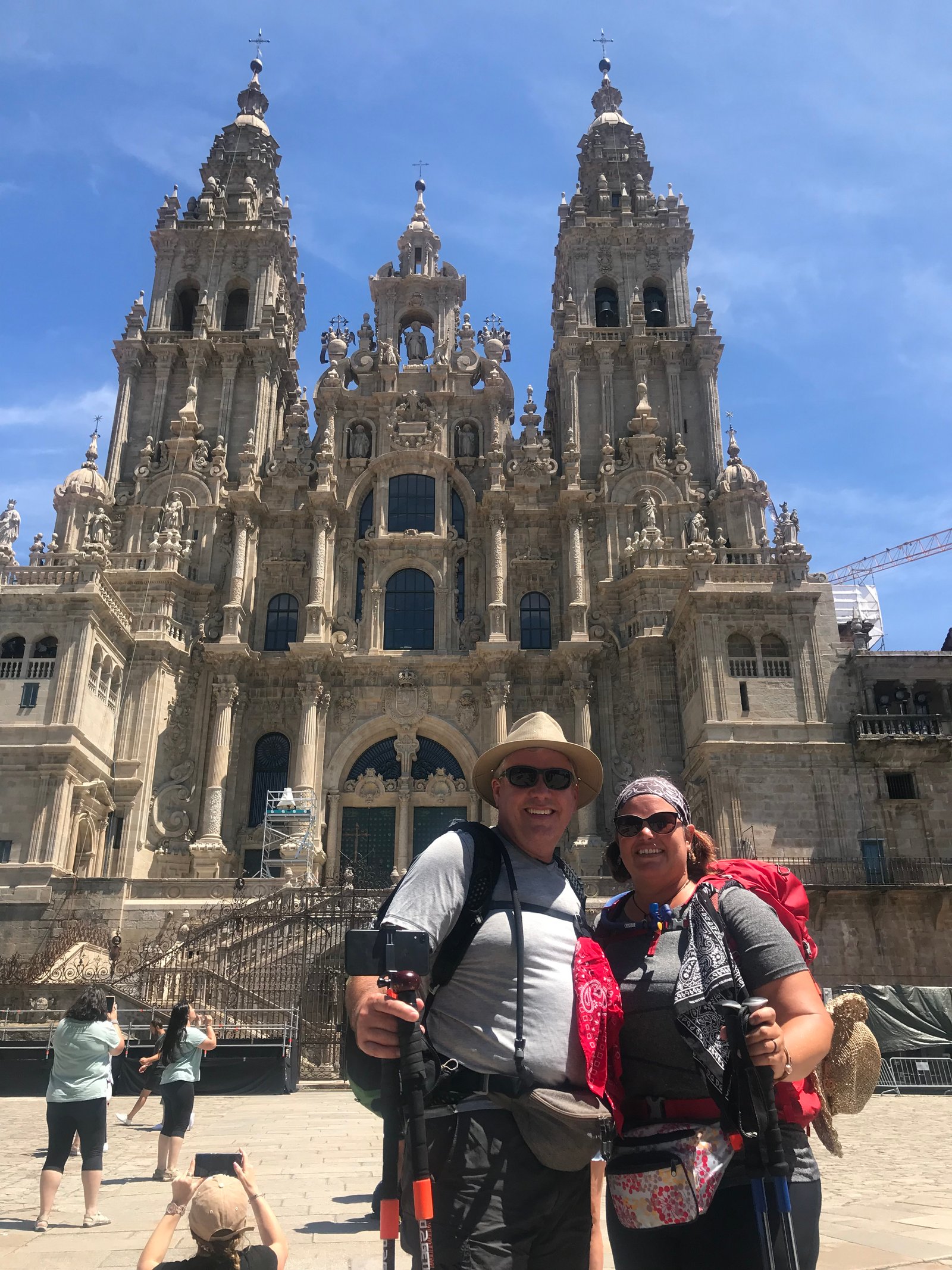
We walked about 300 kilometers on the Camino Frances from León to Santiago in June. Then we flew down to Lisbon, Portugal to complete the Camino Portuguese. We rode bikes from Lisbon to Porto, walked the coastal route from Porto to Caminha, took a boat over to Tui, then finished by walking Tui to Santiago. We arrived in Santiago on July 24th to enjoy the beginnings of the Feast of St. James.
We have one more adventure before we say goodbye to the Camino. We will leave on July 27 to walk to Muxia and then walk on to Finisterre.
You can follow the remainder of our journey on Instagram and Facebook. Our YouYube channel is a few weeks behind where we are now but they are worth the wait for sure!
For now we say, “Buen Camino,” and we will see you when we’re blogging again this fall.
If you are a parent, you know the anticipation your kid’s experience at the start of a new school year and the excitement of summer looming at the end of the year. Teachers have the same feelings. We look forward to starting a new school year; we want to meet our new students, hear about their summer adventures, improve our teaching plans. At the end of the school year, we are spent. Our brains have been in overload for 9+ months, we are mentally and physically tired from the demands of our students and our administration. But before I talk about that and why we travel, let me tell you about what we do as teachers.
Brian and I live in two completely different teaching worlds. For Brian, the middle school and high school choir teacher, he has his nose to the grind day in and day out. He is preparing students for concerts, contests, and assessing their learning five days a week for about 6 1/2 hours a day. When he is not in the classroom he is grading, planning, listening to music, working on the annual musical, and finding new music so he can continue to inspire their love of music from around the world and through the ages.
For me, a Professor of Communication, my pace is a bit slower but just as mentally draining. I spend my days discovering the latest research in my field, working through the technical challenges of online learning, grading research papers, facilitating learning in the classroom, advising students, and meeting the demands of the administrative parts of my job.
Yes, we are blessed to be in similar, even complimentary, professions. Yes, we are acutely aware of how lucky we are to have large blocks of time off together. Twice a year, during Christmas and summer breaks, we are extremely blessed because we have that time off together. Few teachers are that lucky. However, let me take a few minutes to talk about the drawbacks in the education world, as it relates to home/life balance. Balance is something we all have to seek out when it comes to figuring out how much time you should spend on work, with your family, and self-care. The chunk of time needed looks different for everyone and for most balance doesn’t come naturally.
Brian at one of his many concerts
Brian lives by a bell during the school year. If he has students in his classroom, nothing else can matter (even going to the bathroom has to wait). His students and their parents know him very well, many students take choir for up to seven years. In the world of instant access, he is in constant communication with them unless he literally unplugs. Fortunately, I am not in the classroom to the same extent as Brian, it would throw me completely off balance. My days have a bit of research, grading, teaching, and administrative work. My students are in regular communication with me, but certainly not to the same extent. That constant communication, along with all the other demands is draining for both of us and just like every other professional, we need to unplug and recharge.
Michelle hitting the books in her happy place, the library
However, because we have a few large blocks of time, we don’t have much time to unplug during the school year. This is the part that people who are not in the academic world don’t fully understand. For example, during the school year if we have a niece graduating, a child getting married, and an opportunity for a cheap, long weekend, we would have to make sacrifices because we only have three personal days total in an academic year. Now Brian and I have been teaching long enough, that we know those sacrifices are typically manageable. But it’s something we have to explain to friends/family when we are planning out our school year. I am not complaining, we are blessed, but it’s our reality. And I won’t even start on how ridiculous that our Spring Breaks are never on the same week, so we both typically work through them unless we’re lucky enough to still have our personal days so we can leave for a bit on one of the two weeks. But it’s Brian’s busiest season with his musical and my busy time because the end of the academic year is looming, so truly unplugging during either Spring Break isn’t an option.
As I am sure many professionals face, we deal with the constant work pressures, the “Did I send that email?” “Did I forget to tell Sue about the meeting tomorrow?” and just the “What am I forgetting?” feeling, maybe it’s age! Haha! Working professionals are always thinking about work. Unfortunately, some don’t know how or when to unplug. That breaks my heart because unplugging is good for your soul and your relationships.
For us, during the school year, we are often working an average of ten hours a day, six days a week. Brian has a lot of evening and weekend commitments because of the nature of his job and I have a mind-blowing amount of grading. Haha! Therefore, we can’t truly unplug until school is out of session.
Hiking is our balance activity
This is why we love to travel! It’s easier to unplug if you go somewhere that doesn’t have cell service. For us, getting metaphorically “lost in the woods” feeds the soul in a way nothing else can. We figured this out very early in our marriage and have made traveling a priority ever since.
Every time we travel to a new place we realize how big this world is, our “to do” list grows, our time together on Earth feels limited, and our desire to see it all gets stronger. Traveling is more than simply seeing the landscape. Rather, for us, it’s about getting to know the people, the cultures, and learning about the social expectations.
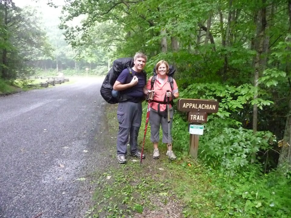
Backpacking a section the AT for my 40th birthday
Traveling makes us better teachers. This isn’t simply becausewe unplugged, though it helps. Because we are responsible for teaching students how to communicate (Michelle) and how to sing cultural and historical pieces of music (Brian), we are better at our jobs because we have these experiences. I have been teaching Intercultural Communication for over 20 years but I have never been as sharp as I have been since I started traveling internationally. When we traveled on the Camino in 2017, Brian heard pieces of music where they were intended to be sung. He experienced the history that he only understood because of book knowledge up until that point.
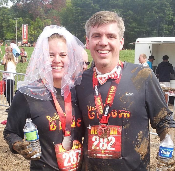
Participating in “Hell Run” mud race for our 5 year anniversary with about 25 of our closest friends
Traveling is good for the soul, whether you hike, bike, kayak, lay on a beach, heat up in a spa, or hole up in a five-star hotel. Next time you travel in the off-season, remember that your kid’s teacher can’t just pull out of school like kids are pulled out of school. However, they are working to finding balance just like you do. They may have to travel during the most expensive times of the school year, but they are thankful for the ability to do it.
Since the establishment of the first National Park at Yellowstone National Park in 1872 more than 1200 National Parks have been established around the world in more than 100 different countries. “America’s best idea” is certainly a great idea for your travel destinations and Michelle and I have made one of our travel goals to visit each of the U.S. National Parks.
The National Park Service (NPS) manages 418 individual “units” but not all of them are National Parks. They include battlefields, memorials, historic sites, lakeshores, and more. Currently, there are 60 National parks and we have visited 24 of them plus numerous other sites managed by the NPS. So here are, in no particular order, our top five National Parks.
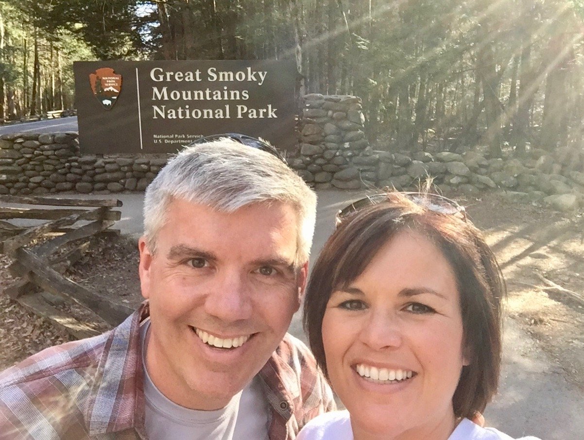
Great Smoky Mountain National Park
No, the name of the park is not spelled wrong! Though there is great debate in some circles on the spelling of the name, no one can deny that Great Smoky Mountain National Park is a magical place. For us, it is only a five and a half hour drive to the gateway city of Gatlinburg, so the Smokies are an idea long weekend getaway.
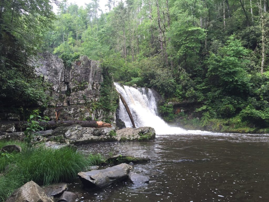
One of the many waterfalls along hiking trails within the park.
The area has something for everyone! There is phenomenal hiking anywhere you go in the park, from “scenic overlooks” that usually include a short trail to technical and advanced trails that take all day, anyone can find a trail that will challenge and delight. For backpackers, there are dozens of backcountry campsites accessible on one night or longers trips. And don’t forget the AT! The 2200 mile Appalachian Trail runs for 71 miles along the Tennesse North Carolina border through the middle of the park. Other highlights in the park include Clingmans Dome, an observation tower at the highest point in the park, biking or horseback riding in Cades Cove, nature drives along numerous routes, and wonderful campgrounds spread throughout the park.
Another draw for many families are the gateway cities into the Smokies. Gatlinburg, Pigeon Forge, Sevierville, and Townsend in Tennesee and Ashville and Cherokee in North Carolina are tourist destinations by themselves and some people never leave town (though that’s quite a shame)! From moonshine and wine tastings to shopping, casinos, and zip lining, the region has something for everyone year round.
Acadia National Park
Acadia National Park is simply put one of the most beautiful places that we have ever visited. Every view looks like it should be on the cover of a calendar. The trails are abundant with more than 150 miles stretching along the coast, up mountains, and through pristine forests. There are bike and boat tours available and you can be the first person in the US to see the sun each morning from the top of Cadillac Mountain, the highest point along the North Atlantic Coast.
You can reach the top of Cadillac Mountain by trail or car, but get there early, most mornings there are hundreds of visitors watching the sunrise.
From the quaint town of Bar Harbor, Maine, you can book sea kayak tours, stroll the quiet streets, and eat and sleep in places that look as if they haven’t changed much in the last fifty years (that’s a good thing, really). We only spent a few days in Acadia back in 2010, but it is at the top of our list for a return visit the next time we tour the East Coast.
The view overlooking “the bowl” on Champlain Mountain.
Zion National Park
It’s time to head west where the parks sprawl across deserts, prairies, and mountains. While many people are quick to sing the praises of the Grand Canyon (and it is spectacular), we would direct you to another giant hole in the ground – Zion National Park. Utah’s first National Park is one of it’s most magnificent!
The main canyon has two entrances, one from the city if Springdale and the other through the Mount Carmel tunnel.
Zion’s fifteen-mile long canyon sinks into the plateau to a depth of almost 2600 feet (only a third of the depth of the Grand Canyon) but because of its relatively small size you are always up close and personal with the canyon walls and the views are breath-taking!
The view of the canyon from the top of Angel’s Landing.
The top attraction at Zion is the hiking and these trails are not for the faint of heart. With summertime temperatures often topping 100º, hikers start early. The biggest advantage here is that most trails climb from the canyon floor, meaning you can go as far as you like and then turn back for the “easier” descent back to the road (as opposed to having to climb out of the Grand once you’ve already reached exhaustion). Trails range from moderate to insane with the most extreme hike being to the top of Angel’s Landing, a file mile out and back that climbs nearly 1500 feet straight up a rock that juts from the canyon wall. The trail is only a few feet wide in some spots with sheer drops on both sides and only a chain to hold on to for two-way traffic.
Angel’s Landing’s chains are not for the timid.
Another popular hike is the Narrows. The Virgin River becomes the trail as hikers squeeze through slots in the canyon, climbing waterfalls, and sometimes swimming through deeper segments. The effort is worth it in spots such as Wall Street where the canyon narrows to 20 feet wide and 2000 feet deep.
The Narrows is a popular hike in the summer heat.
The gateway city of Springdale has a Bohemian artist vibe with wonderful shops, restaurants, and much-needed air conditioning.
The entrance to the Narrows trail.
Another view from Angel’s Landing.
The “trail” in the narrows.
Glacier National Park
Heading north, we have to send you to Glacier National Park in Northern Montana. Camping, hiking, boating, cross-country skiing, and biking are just some of the popular activities in this inspiring park that shares a border with Canada’s Waterton Lakes National Park.
One of the trails in the Logan’s Pass area of the park.
Driving along Going to the Sun Road is a popular activity and the views are wonderful. Get out along many viewpoints and take a short walk along one of the many trails and you are sure to see wildlife. The lodges throughout the park are historic and an attraction alone.
We witnessed moose, bighorn sheep, mountain goats, bears, and marmots along the many trails we hiked.
Don’t forget to make a trek out to see the dwindling glaciers. Some scientists’ estimate that all of the glaciers in the park may be completely melted within the next ten years, so don’t wait!
The Salamander Glacier from above.
The runoff from the Grinnell and Salamander Glaciers as the melt.
Yosemite National Park
Rounding out our list is Yosemite National Park in Central California. Best known for its many waterfalls, Yosemite is a sight to behold. With more than 1200 square miles, this park is remote and anyplace in the park that you choose to visit is going to be a drive, but what a drive it will be!
Spectacular view of Yosemite Valley
Hiking is the main attraction here but rock climbing is also a very popular sport. On any search of a granite wall, you will likely find a tiny speck of a rock climber working his or her way up the rock face. This place is huge in its scale and awe-inspiring at every turn.
Plan ahead because some popular hikes, such as Half Dome, require a lottery entry to win a permit. If you can’t get one of those coveted permits, check out Clouds Rest, a 14 mile out an back hike that will take you through a wide range of Yosemite’s terrain and finish (at the turnaround point) with a stunning view looking down at Half Dome. This is a serious hike and not for those afraid of heights!
From Cloud’s Rest, Half Dome is visible to the right of center.
The hike to Cloud’s Rest can be nail-biting at times.
In the coming weeks, we’ll be talking more about our favorite National Parks with some guides to our favorite hikes and other activities while visiting. Let us know in the comments where you want to hear about from our NationalParksMap below.
I can’t wait anymore – I have to talk about the Camino! There is so much to say! This is the first of several blog posts over the coming months on the subject of the Camino de Santiago. We hiked the Camino Frances in 2017 which was a life-changing experience for both of our adventurous spirits. Many times we had heard the phrase, “you never hike the Camino just once,” but we had no idea what it meant until the draw of the Camino pulled us so hard we could not resist it. I have to admit, I am still shocked at how much I want to go back and hike the Camino again. Brian felt the same draw to go back, but he wasn’t as surprised as I was. There will be more on the reasons we both felt the draw in future blog posts.
Let me begin by telling you some people decide to hike the Camino and don’t plan a thing. This is not who we are, we like to plan, I can go so far as to say we love to plan. Spreadsheets are life to us! For us, the spreadsheet takes something that can be quite intimidating – hiking across a country – and making it more manageable. Our spreadsheet broke down the 550 miles trek into small sections so we had more confidence and set achievable goals. All of that being said, we have a lot of respect for the many thousands of people who complete the Camino annually without any planning. There is something to be said about just picking up and going, just because it is not for us doesn’t mean we don’t admire those who do.
It was about May 2018 when we both finally admitted to one another that we wanted to go back to the Camino; it was less than a year from being back in the states from our Camino 2017. I remember where we were standing in the new house we just purchased in April 2018 when we admitted our desire to hike the Camino again because my heart skipped a few beats. It took a few months to make any progress on that decision, mainly because we were in the midst of preparing for our son’s wedding and our summer 2018 adventure but we knew we were going! We plan the details of our next big summer adventure the moment we finish the adventure we are on and often while we are on the current summer adventure. So in September 2018, the real planning began. Determining when we are going to travel is not a step for us because we are teachers so we know that we’re traveling in June and July whether we like it or not. With that being said, before I outline the steps we have taken thus far, I strongly encourage you to join the American Pilgrims on the Camino Facebook group. With over 18,000 members, everything and anything you need to know to plan your Camino is in that group! Ok, without further delay, here are the steps we have taken thus far to plan our Camino 2019: Monitor International Flight Prices
I cannot tell you how important it is to sign up for some sort of flight monitoring website. We signed up for a few and the winner of finding our cheap airfare was Scott’s Cheap Flights. You can pay up to about $1500 a person to fly internationally but with a bit of legwork, you can fly a lot cheaper. A couple weeks ago, I received an email from Scott’s Cheap Flights that Air Portugal was having a great sale so did further investigating and found great prices. If you are willing to fly from one of the main hubs (we picked Boston), they had round-trip tickets as cheap as $300. This means we still need to get to Boston, but we will monitor flights until we find a good price to get to Boston. Determine the Route
Next, you need to determine which of the Camino de Santiago routes you will choose to hike. The most popular and the one we did in 2017 is the Camino Frances. Many people are inspired to hike the Camino Frances because of the 2010 movie, The Way, starring Martin Sheen, and we were no different. The moment we saw this movie we knew it was a bucket list adventure, and it only took us seven more years to get there.
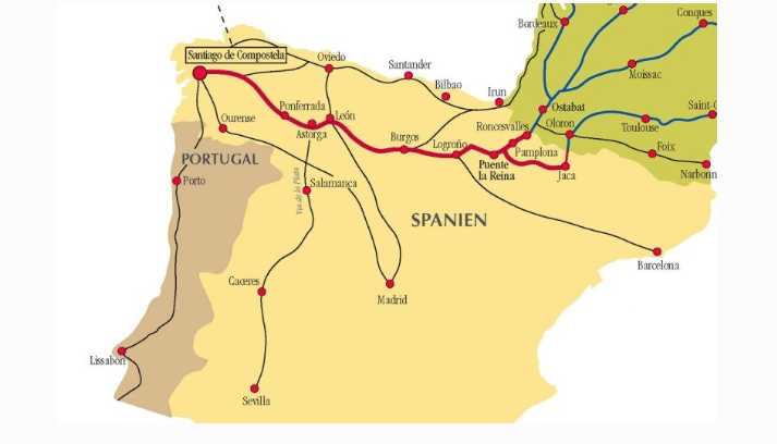
This time we are going to hike the Camino Portugués which is 640 kilometers. Since we have the time, and we want to go back, we are going to hike part of the Camino Francés from Leon to Santiago. Finally, we are going to hike the “extra loop” to the “end of the Earth” which is Santiago de Compostela to Finisterre to Muxia and back to Santiago. We hiked to the end of the Earth in 2017 to celebrate our anniversary but this time we want to complete the loop and go on to Muxia and then walk back to Santiago. Our total hiking mileage is coming it at 1162.3 kilometers. This is epic for us! The last time we were there we had 38 hiking days, averaging about 14 miles a day. This time we will hike 44 days and average 26.4 kilometers or 16.4 miles a day. We like a challenge – and well – we have one before us! Buy Guidebooks
There are several guidebooks out there about the Camino and we have two favorites. The first, and most popular, guidebooks are by John Brierly and you can find any of his books on Amazon. This is the basis for our spreadsheet and provided us with everything we needed to know about hiking the Camino from villages, distances, terrain, details about where to stay, and notes of stuff to watch out for as you travel. Many people carry his book with them on the Camino and just rip out pages as they don’t need them anymore or they have the electronic version on their Kindle.
The second guidebook we use is the Village to Village guidebook by Anna Dintaman and Matthew Harms, their books can also be found on Amazon. You should also check out their website too. It has been a great resource for planning where to stay, what to wear, what to take, and has links or email addresses to albergues.
Buy your guidebooks about 6-8 months before you leave. You don’t want to buy them too early because you want the latest edition; however, you want to buy them early enough to have the time to read the books so you can, at least, mentally prepare for this undertaking. Make Spreadsheet
Disclosure: We were not the original creators of this massive spreadsheet! One of our fellow Ohio APOC friends, Greg, created this spreadsheet and shared it with us. We have shared it with others so as to pay it forward because if you are a planner, this spreadsheet is amazing!
Ok, here is where we went crazy! But you need to know that we plan our summer adventures with this type of spreadsheet every year. Our rationale is that when we are gone for two months, we need a spreadsheet to ensure we meet our goals for the adventure.
For our first Camino, we were not going to plan anything because we heard that most people don’t plan their daily goals on the Camino. It was about five months before we left for the Camino when we decided the no-planning philosophy was not going to work for us. There were a few determining factors going on here – (1) we have to travel during the busiest season, (2) we heard stories of people coming into a village and there were no rooms left (and we saw this happen!!), (3) we wanted to know where we were sleeping each night even if we had to bus ahead due to illness or injury, and finally most importantly, (4) our minds were at ease the moment we started planning our stays. For us, the spreadsheet is our lifeline and we love having it. Would we ever go without one? We could, yes. If we were only going for a couple of weeks, a good possibility, yes. If we weren’t going during the busy season, possibly. It is all a matter of preference. Training Time
If you have the time, we would strongly encourage you to start walking! Walk 5, 8, 10 miles at a time as much as you can, build up to longer walks whatever that looks like for you. Start where you are comfortable to prevent injury. Since we are still about seven months out, we are walking once or twice during the week and have one long walk on the weekends. Do what works in your schedule. If you can get consecutive long walking days in, that would be perfect for your training! If you have any old Roman roads in our neighborhood, walk on them! Haha But seriously, do not go for a walk in the woods, which is what we would normally be doing. Walk on gravel roads, brick roads, pavement, anything to toughen up your feet. Carry a backpack with about 12-15 pounds in it during the last couple months of your training. I will talk about gear, I promise, in another Camino post! For now, here are a few more big suggestions to train for your Camino:
See your podiatrist and get insoles. They saved our feet! You have to find the shoes and insoles that work for your feet. It is critical. We both love Merrell shoes and insoles that are fitted for our feet.
Know how to care for blisters (see the APOC Facebook group, everyone has an opinion on what to do)
Do lunges and squats, just 10-20 a day, 3-4 days a week. Your knees will thank you for that specific training, I promise you!
Have your backpack fitted, we went to REI and both love our packs for different reasons.
When you know what you are going to wear on the Camino, wear it in your training. You want to minimize gear surprises.
Don’t overthink the training, just walk. There are people of all ages, backgrounds, and fitness levels on the Camino. We met two 12-year-old girls hiking the Camino, lots of 20, 30, and 40 something folks, and even more 50, 60, 70+ folks walking the Camino. If you can walk, you can walk the Camino. Even if you can’t walk the Camino will provide, see the 2017 movie, I’ll Push You if you need the motivation to walk the Camino. Extra Step: Making Reservations
This step is not for everyone but it certainly made our Camino the most “relaxing” adventure we have ever had! I referenced making reservations in the “Creating the Spreadsheet” point but it needs to be clarified. The site we used to make most of our reservations was Booking.com. It won’t help you with every single reservation, for some villages you will need to email the albergue to make your reservation because they are not on Booking.com.
Before you make your reservations, check out the APOC Facebook group because everyone is talking about various albergues and may provide you with insight about where you want to stay or avoid staying because it does not meet your needs.
I didn’t talk about the budget in this blog, it’s a topic for another post. However, in short, you can spend very little or stay at 5-star hotels throughout your journey. You can find municipal albergues for $3-5 a night. We averaged about $40 a night for a private room. Sometimes that included dinner but often, for us, it did not. I will talk more about our “teacher budget,” this means that we had more resources than a college student but not as much as someone from Corporate America.
There are so many blog posts about the Camino, this is just our point of view from our experience. Read as much as you can before you hike your Camino. It’s your journey, it’s your Camino, make it what you want it to be. As we say on the Camino, Buen Camino!
Our time in the upper peninsula of Michigan began at Pictured Rock National Lakeshore. We were here a few years ago, but when we decided we were going through the UP this year, stopping at Pictured Rock was a no-brainer.
Before we jump in, I have to tell you that we skipped Tahquamenon Falls State Park and we regret it. The park is beautiful with upper and lower waterfalls, great hiking, and a wonderful campground. If you make your way to the UP, stop at Tahquamenon Falls. Also, make sure you stop at the Tahquamenon Falls Brewery and Pub which is located in the park at the trailhead to the upper and lower falls. The food is outstanding and the beer is bubbly good!
To best explore Pictured Rock, we camped at the Munising Tourist Park and highly recommend it. We stayed at this campground the last time we were through here. The reason we love this campground is that it is right on Lake Superior. The sunsets will take your breath away! Campsites #72-80 provide the most privacy, have plenty of room for RV’s, and are right on the water. It’s a small campground but there is a playground, it’s right off M-28, and of course, it’s on the water! This city of Munising is a small but quaint town to just wander around. We love hanging out at Falling Rock Cafe and Bookstore. The food is fabulous and it’s a good place to enjoy one of the many books on their bookshelves.
Let’s get to it – here are 6 reasons we made Pictured Rock National Lakeshore a priority in our UP travels.
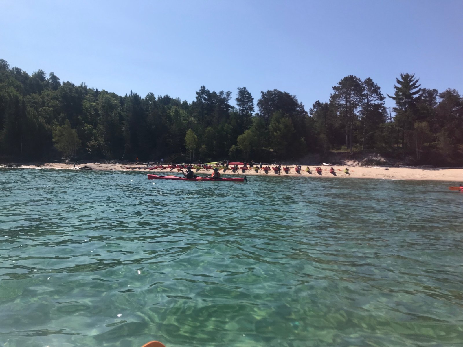
#1: Sea Kayaking
Of course, I have to start with sea kayaking because it was the primary reason for stopping here. There are several companies that have half day and full day tours, we chose Northern Waters for our tour this time around. Kayaking on Lake Superior is some of the most beautiful kayaking we have ever done. You go out in a tandem kayak so make sure you bring someone you trust, haha. Every company we have gone with does a great job of providing the group with some basic kayaking training. However, we would suggest you are not brand new to kayaking as it will really slow the entire group down. In Dayton, we have Five Rivers MetroParks and they do a fantastic job of providing people with opportunities to “try out” various sports to prepare you for activities like this one. If you are a more experienced kayaker, we strongly suggest going on a full day tour as you won’t have as many new folks.
If kayaking is not something you can or want to do, there are plenty of boat tours so you can still explore Pictured Rocks.
#2: The Colors Pictured Rock lives up to its namesake and is simply stunning. When the sun hits the rock the color explodes. There are all of these nooks and crannies to slide your kayak into and feel like you are holding up a thousand plus tons of rock. Just look at the pictures below. If you like what you see, imagine how gorgeous it looks in person. It left us speechless.
#3 Rock Formations
I love sliding the kayak through these small spots! You have to wonder how or when this happened to the rock. The last time we kayaked this area we came around a corner only to see a big wave and a lot of kayakers looking up. A big piece of rock fell right before their eyes! Fortunately, nobody was hurt but a lot of people were quite startled. I am conflicted – I wish I would have seen it but I doubt we would have come back, haha!
#4: The Clear Water It feels like you can see all the way to the bottom of this very deep water. The only other time I have seen water this clear was in Florida as I snorkeled around the coral. I am confident there are places around the world with crystal clear water, but I was raised on the Mississippi River and there is nothing clear about that body of water. Therefore, when I am around clear water, I am mesmerized. There is something so breathtaking about crystal clear water. At one point the guide showed us a ship wreckage and it was amazing how much you could see. If I had the right gear, I would have loved to have snorkeled around it. Lake Superior was a warm 60 degrees the day we were on it.
#5: The Hiking The best part of Pictured Rock National Lakeshore is there is so much more to do besides kayaking. You can day hike and backpack the area. According to the National Park Service, you can backpack about 43 miles. We did a 10-mile loop to explore Chapel Rock and the Mosquito Falls area. Pictured below is Chapel Rock, a most impressive balancing rock overlooking Lake Superior.
#6: The Waterfalls
You can see about 18 waterfalls in the Munising area. The last time we were here it was our goal to see all of them! This trip we didn’t have the time so we only saw a few. The one pictured below is Miners Fall which is part of an easy 1.2 mile hike. There are some waterfalls that you can only see from a kayak and some only after a good rainfall. Then there is Mosquito Falls which you only see if you are covered in enough deet, haha!
That is an oversimplified summary of Pictured Rock. We didn’t explore the Grand Island National Recreation Island and we wish we would have had time to do it, but you can only do so much when you have time constraints. Pictured Rock is a beautiful place to visit with plenty to keep you busy. If you check it out, let us know your favorite spots. If you liked what you read here, be sure to like and/or comment on the post so we know what you want to hear more about next time.
Until we adventure again…
★ 25 years guiding★ 48 U.S. states★ 10 countries★ 3,000+ Camino miles
RV tips, travel inspiration, and updates on the trips we're planning — delivered to your inbox each month.
Questions about this trip?
Send us an inquiry.
Tell us what you'd like to know about this trip and we'll get right back to you.
Know before you go
Activity Level.
Every Cruisin' with the Colemans trip comes with an activity level so you know, before you lace up, roughly how hard the walking will be. Think of it as the overall rhythm of the trip — a few days might push a little past it and a few will feel gentler, but it's an honest read on what your legs are signing up for.
Nobody knows your body better than you do. We're all for a good challenge, but pick a level that matches your current fitness and trail experience and the whole walk gets more fun. Not sure where you land? Reach out — we've walked every one of these ourselves and we're always happy to talk it through.
Grades
EasyEasy0–8 km (0–5 miles)
Gentle, mostly flat days on well-kept, easy-to-follow paths. Ideal if you're new to multi-day walking or simply want a relaxed pace with plenty of time to soak it all in.
Easy – ModerateEasy–Moderate8–16 km (5–10 miles)
A little more distance over mixed ground — mostly maintained trails, quiet lanes, and the occasional gentle climb. A good fit if you're reasonably active and ready for a few longer stretches.
ModerateModerate16–20 km (10–12 miles)
Fuller days on varied, sometimes rugged terrain with regular ups and downs. Great for steady hikers in good shape, or determined first-timers chasing a real sense of accomplishment.
Moderate – StrenuousModerate–Strenuous20–24 km (12–15 miles)
Long days with sustained, often steep climbs and descents on rough trail. You'll want solid fitness; a few exposed spots call for a head for heights, and navigation can get trickier when the weather turns.
StrenuousStrenuous24–28 km (15–17 miles)
Big days on demanding, often remote mountain terrain — serious distance and elevation for experienced, fit hikers. Expect rough footing, the odd exposed or aided section, and higher altitude on some routes.
ExtremeExtreme+28 km (+17 miles)
Our toughest walking, built for very fit, very experienced hikers. Rugged, sometimes remote mountain terrain with scrambling, exposure, and aided sections — plus altitude, weather, and navigation that all add to the challenge.
Where you rest
Accommodations Levels.
Where you sleep is part of the story, so we hand-pick locally run places that welcome you like an old friend. The level shifts a little from trip to trip depending on the route, but the goal never does: a clean, comfortable, genuinely local stay at the end of every walking day.
Most nights you'll land in friendly, independent or family-run hotels, guest houses, and B&Bs chosen for their charm and the little touches that feel like home. Some trips lean a touch more luxurious; others, especially in the remote stretches, mean simpler refuges or huts. Either way, we've picked each one to help you rest up and wake ready for the trail.
Basic – A Place to Rest Your HeadBasic
Mountain huts, refuges, and simple B&Bs. Ensuite rooms aren't a given, and you may share a dorm with fellow walkers — but what you trade in polish you more than gain back in camaraderie and a big, rustic welcome.
Classic – Charming Without the FrillsClassic
Locally owned B&Bs, guest houses, and small inns that feel like a home away from home — usually family-run, cozy or freshly kept, and well placed for the next day's walk. A warm welcome comes as standard.
Comfort – A Little More...ComfortableComfort
Characterful, locally owned hotels and B&Bs with the little extras that make a stay feel special — décor rooted in the region, the occasional spot to unwind, and sometimes a kitchen worth lingering over.
In Style – For Those who Want to Treat ThemselvesIn Style
First-class stays in boutique hotels, vineyards, and country manors — often in the best seats in the house, from hilltop towns to the water's edge, with standout service and, now and then, a truly memorable table.
Mixed – Boutique Hotels to Mountain Huts, all in One TripMixed
One trip, a bit of everything. You might bed down in Classic or Comfort rooms through the towns and villages, then a refuge or other Basic spot up in the mountains where that's all there is — an honest, memorable mix that matches the journey.